UAV-UGV Collaborative Mapping

Aerial-Ground Collaborative 3D Mapping Datasets

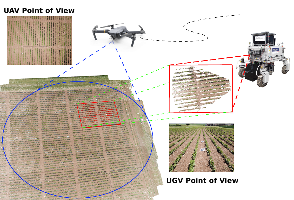
The combination of aerial survey capabilities of Unmanned Aerial Vehicles with targeted intervention abilities of agricultural Unmanned Ground Vehicles can significantly improve the effectiveness of robotic systems applied to precision agriculture. In this context, building and updating a common map of the field is an essential but challenging task. In order to benchmark 3D multi-robot SLAM and map registration algorithms in agricultural scenarios, we collected three challenging datasets of three crop types in Eschikon, Switzerland, at ETH crop science facility. All the datasets include geo-tagged 3D maps registered by UAV and UGV robots with their relative ground truth.

In the following, the complete dataset list:

Soybean Dataset: 20180524-mavic-soybean.zip
Winter Wheat Dataset: 20180311-mavic-ww.zip.zip
Sugar Beet Dataset 10m: 20180524-mavic-sugarbeet-10m.zip
Sugar Beet Dataset 20m: 20180524-mavic-sugarbeet-20m.zip


Each dataset contains:
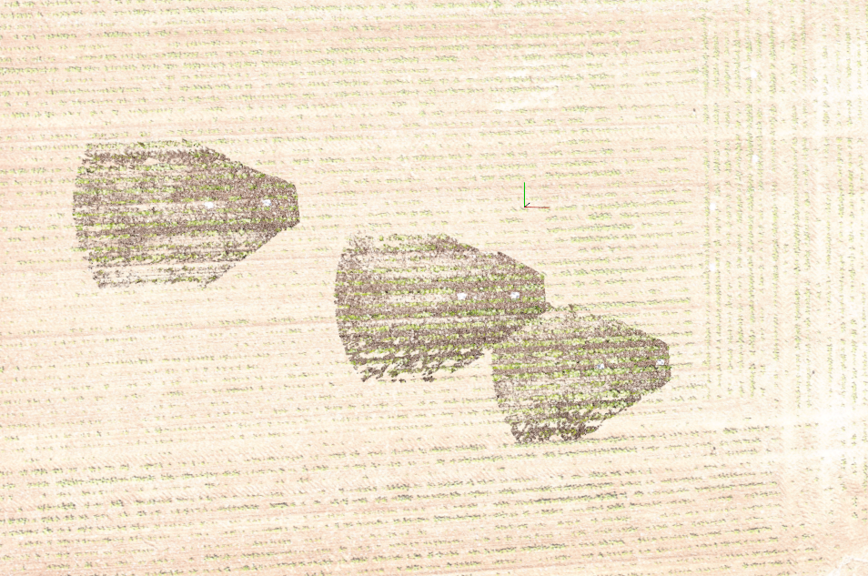
<acquisitionDate>_mavic_uav_<cropType>_eschikon: folder containing the UAV colored point cloud
<acquisitionDate>_mavic_ugv_<cropType>_eschikon_<rowNumber>: folders containing the UGV colored point clouds according to their rowNumber
More specifically, each folder contains:
  • offset.xyz: initial guess global position (GPS), attitude and heading (AHRS)
  • point_cloud.ply: colored point cloud in Polygon File Format (PLY) format

Software

In addition to the datasets, we provide a 3D map registration software package we developed within the Flourish project:

  • AgriColMap: a tool developed to register 3D maps gatherd by aerial and ground farming robots [source code]

News


Released the AgriColMap library version working with Open3D. To test this new version, please download the modified datasets from here

check out also our video:


When using this dataset and/or software in your research, we will be happy if you cite us:

                            @article{pknsnp_RA-L2019,
                                title={{A}gri{C}ol{M}ap: {A}erial-Ground Collaborative {3D} Mapping},
                                author={Potena, Ciro and Khanna, Raghav and Nieto, Juan and Siegwart, Roland and Nardi, Daniele and Pretto, Alberto},
                                journal={IEEE Robotics and Automation Letters},
                                volume    = {4},
                                number    = {2},
                                year      = {2019},
                                pages     = {1085--1092},
                                doi={10.1109/LRA.2019.2894468}
                            }

Acknowledgment

The authors would like to thank Hansueli Zellweger from the ETH Plant Research Station in Eschikon, Switzerland for preparing the fields, managing the plant life-cycle and treatments during the entire growing season. The authors would also like to thank Dr. Frank Liebisch from the Crop Science Group at ETH Zurich for helpful discussions.